Publications and research outputs
We aim to make the outputs of all our research freely available and easily accessible.
Research outputs produced by JBA Trust are available in a wide range of different formats, including journal papers, posters, reports, data and code.
We have also developed specific learning resources to support our education and STEM activities in schools around four main themes: rivers, coasts, catchments and flood risk modelling and mapping.
Explore our publications and research outputs below
- All
- Code
- Data and tools
- Journal paper
- Maps
- MSc
- PhD
- Poster
- Presentation
- Report
- Video
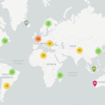
Interactive map of places mentioned in research studies, published between 2017 and 2023, about working with natural processes to reduce the risk of flooding.
Tharindu Manamperi shares his latest research to help predict shoreline change using deep learning methods
Freya Muir publishes her research in ‘Earth Surface Processes and Landforms’ as well as an open-source tool for mapping coastal change, known as VedgeSat.
Two papers published in the Journal of Hydrology explore how to quantify the impacts of natural flood management (NFM), specifically leaky dams in upland catchments, on the downstream flood peak magnitude.
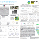
This poster explores the impact of the Studentship Awards which support talented students to undertake a hydrology related masters course.
The flood hydrology roadmap sets out a vision to help scientists and practitioners across the UK better predict future flood events and improve flood resilience across the UK.
This page hosts a database listing flash flood events in the UK derived from historical reports dating back over more than 200 years.
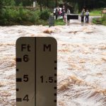
New research explores events in northern England where river water levels rise very rapidly and are extremely hazardous to river users.
This tool provides a quick and accessible analysis that can support modelling of leaky barriers across different levels of detail, from simple site assessment through to intermediate or detailed models
Published research by Jake Grainger explores statistical techniques that better utilise ocean buoy data to help characterise the ocean wavefield.
In this article, we explore the importance of earth observation (EO) data for identifying flood extents and how a new method for validating flood maps enables a quantitative, location specific measure of flood map accuracy
Luke Jenkins publishes research in ‘Natural Hazards’ that provides evidence for the prevalence of consecutive storms, big waves or high tide events occurring over a short period of time (known as clustering) around the UK.
Research outputs from a PhD to investigate the resilience of natural flood management (NFM) systems.
Research outputs from a PhD to estimate flood frequency using documentary and floodplain sedimentary archives to extend flood series.
Understanding the characteristics of wind-generated waves is important for modelling structural responses in ocean engineering. This paper explores statistical techniques to improve the understanding of estimated parameters of wind-generated waves and help oceanographers gain insights into their behaviour.
MSc project poster – Luke Hussey assessed the impact of rewilding the Broughton Hall Estate using a natural capital approach.
This study developed and trialled new surface water flood (SWF) forecast products in a flood incident workshop and makes recommendations for the application of future forecast information and processes.
This network model highlights the need for robust design of nature-based flood risk measures and allows rapid assessment of the whole-system performance of leaky barriers in real stream networks.
This paper explores how flood risk management can utilise the exponential increase in ‘big’data’ generated by a range of sources including satellites, mobile phones, ground-based sensors and citizen science. It proposes approaches to collate, integrate and query data from unstructured and disparate data sources.
A summary of the PhD research carried out by Tom Padgett into how weirs, fish passes and hydro-electric plants can best be configured to avoid disruption to eel and fish migration.
Analysis of local authority areas where different types of tree planting (floodplain, riparian, wider catchment) could help reduce flood risk
This report aims to help identify the data and modelling needs, and the robustness of evidence, for developing Natural Flood Management strategies in the Skell catchment to reduce flood and sediment risks.
MSc project poster – Emma Brook investigated the feasibility of community scale renewable energy for the Malhamdale community in North Yorkshire.
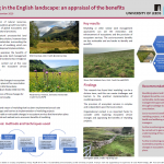
MSc project poster – Anthony Royffe appraised the benefits of rewilding as a landscape-scale land management approach for upland and lowland areas of England.
A summary of the research carried out by Jenny Broomby for her MSc in Sustainability and Consultancy at the University of Leeds.
A summary of the research carried out Leanne Archer during her Masters by Research (MScR) at the University of Bristol and presented at the 2018 European Geosciences Union General Assembly (EGU).
In this presentation Professor Rob Lamb explains how our recent research is demonstrating a plausible correlation between increased flood risk and anthropogenic climate change.
A new study shows how the topographic and sediment data collected using terrestrial lidar surveys can be used to provide boundary conditions in a range of widely accessible flow models and could help add further insight to the hydromorpological analysis of a river reach.
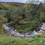
JBA Trust monitored and documented the rare emergence and flow of the Assendon Stream in 2014 to provide a resource for researchers and practitioners interested in understanding more about this type of groundwater flooding event.
As part of Eleanor Pearson’s PhD placement with JBA Trust, she investigated whether the outputs from pre-existing flood risk hydraulic models can be used to evaluate the geomorphological impact of a flood. Results from her work are presented in this poster.
Professor Rob Lamb, Director of JBA Trust, provides an update on our collaborative research with the Infrastructure Transitions Research Consortium (ITRC) team at Oxford University.
Working in partnership with the Zurich Insurance Group we have released a report detailing first hand experiences of flooding in Cumbria following Storm Desmond in December 2015.
We are collaborating with the Infrastructure Transitions Research Consortium (ITRC) team at Oxford University to research and analyse railway bridge failures.
We supported the development of a new tool to identify and assess the potential multiple benefits of SuDS schemes.
We have published a consolidated chronology of railway asset failures relating to flooding for the period 1846 to 2013. The most common failure mechanism was found to be the undermining of abutments or piers by scour, resulting in their collapse.
This page has been superseded by a new page about our interactive mapping of nature-based flood risk management projects across the UK. You can find the new page here: https://www.jbatrust.org/how-we-help/interactive-mapping/
The JBA Trust is working with Lancaster University to develop improved models for extremes of localised and widespread flooding.
Research outputs from a PhD investigating modelling approaches for catchment flood management.
MSc project poster – a summary of the research carried out by Robert Bertsch for his MSc in Hydroinformatics at Newcastle University.
A poster of the research carried out by Nicole Friedrich Neumann for her summer project in Environmental Sciences.
MSc project poster – a summary of the research carried out by Marion Duprez for her MEng in Civil Engineering at Newcastle University.
MSc project poster – a summary of the research carried out by Sarah Usher for her MSc in River Basin Dynamics and Management with GIS at the University of Leeds.
MSc project poster – a summary of the research carried out by Jessica Scrimshaw for her MSc in Sustainability (Environmental Consultancy and Project Management) at the University of Leeds.
MSc project poster – a summary of the research carried out by Janie Haven for her MSc in Water and Environmental Management at the University of Bristol.
A poster, presentation and workshop resources from the research carried out by Ross Towe.
MSc project poster – a summary of the research carried out by Gary Chan for his MSc in Sustainability and Consultancy at the University of Leeds.
MSc project poster – Zhiqi Hu investigated if observations of floods from satellite images can help us improve the accuracy of forecast flood maps.
The environmental community team up with mathematicians to tackle the challenge of understanding the risks associated with nature-based flood risk management measures deployed on river networks.
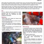
MSc project poster – Alice Dear investigated where the construction industry (particularly flood risk management) can reduce single-use plastic (SUP) consumption and improve waste management sustainability
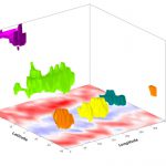
The environmental community team up with mathematicians to tackle the challenge of ‘identifying coherent weather features in three dimensions’ and publish a Challenge Solutions Report.
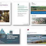
Flood risk and resilience have been under review in recent years, following severe flooding in 2013/14 and 2015/16, previous flood events and concerns over changes in physical and economic climates. This talk examines some important governmental and technical reviews, discussing scientific themes that run through them: The National Flood Resilience Review (September 2016) House of […]
The Government’s 2016 National Flood Resilience Review[1] (NFFR) found that “while the probability of an extreme river flow that could result in a severe flood at any given location is very small, such flows are not unusual when considering the whole country”. This statement was one of the conclusions of the Scientific Advisory Group (SAG) [...]
In partnership with The University of Gloucester, we delivered four workshops on different aspects of river restoration
The JBA Trust supported the Holnicote Project with a position paper on rural land management change.
This NERC funded project aimed to transfer advances in statistics to flood risk science.
Computer model experiments allow us to investigate the influence of climate change on flood risk.
New research shows that a 2D, depth-averaged model can reconstruct hydrodynamic and morphological features at a channel bend
Working with Newcastle University, we compared surface water flooding models with crowdsourced evidence of the 2012 ‘Toon Monsoon’.
We sponsor the JFRM Outstanding Paper Award to enable the winning paper to be made freely available on the Journal webpage.
New paper reports a probabilistic analysis of the risk to the British railway network from scour at bridges.
An international expert elicitation workshop provides new insights into the vulnerability of UK bridges to scour
The JBA Trust worked with MSc student Janie Haven to compare national flood risk assessment models with real flood events.

