Flood Inundation Mapping with Data Assimilation
As part of her MSc in Atmospheric Ocean & Climate at the University of Reading, Zhiqi Hu investigated if observations of floods from satellite images can help us improve the accuracy of forecast flood maps.
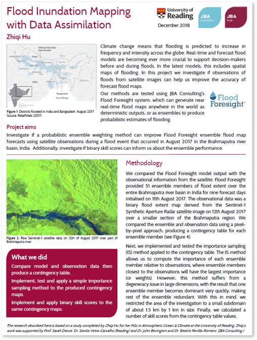
Climate change means that flooding is predicted to increase in frequency and intensity across the globe. Real-time and forecast flood models are becoming ever more crucial to support decision-makers before and during floods. In the latest models, this includes spatial maps of flooding.
The methods were tested using JBA Consulting’s Flood Foresight system, which can generate near real-time flood maps anywhere in the world as deterministic outputs, or as ensembles to produce probabilistic estimates of flooding.
Zhiqi’s research is summarised in this poster