New research improves forecast flood maps using earth observation data
In August 2022, devastating, widespread flooding in Pakistan displaced 33 million people. This flood highlighted the importance of earth observation (EO) data for observing flood extent.
These flood maps give vital information to emergency response teams and aid operations. They also benefit flood forecasting agencies, who often use hydrometeorological models to predict the evolution of flooding extent.
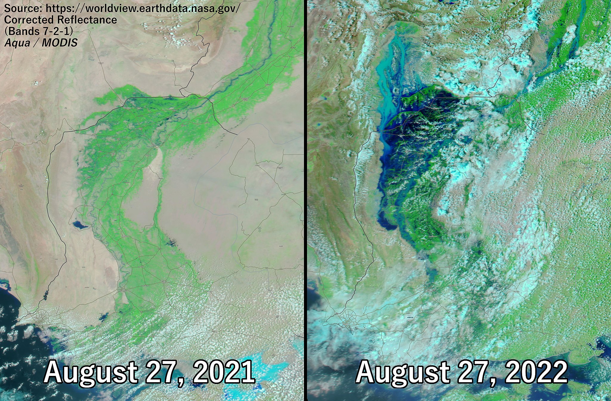
2022 Pakistan Floods – August 27, 2021 vs. August 27, 2022 in Sindh. Source: NASA
Research carried out by Helen Hooker, a PhD researcher at Reading University, has identified a new method for validating flood maps using a scale-selective approach.
 Helen’s research paper on ‘Spatial scale evaluation of forecast flood inundation maps‘ was recently published in the Journal of Hydrology.
Helen also discusses her research in an article for JBA Trust, explaining how the accuracy of flood forecasting maps is measured and how a new scale-selective approach enables a quantitative, location specific measure of flood map accuracy.
Full article: Improving forecast flood maps using earth observation data