Putting science on the map
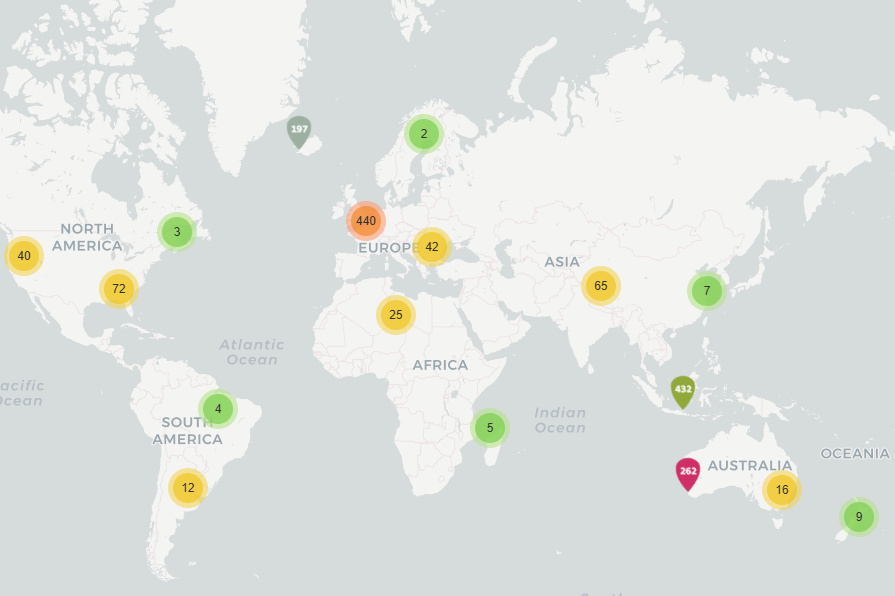
Our new map shows the location of research studies about working with natural processes (WwNP) to reduce flood risk
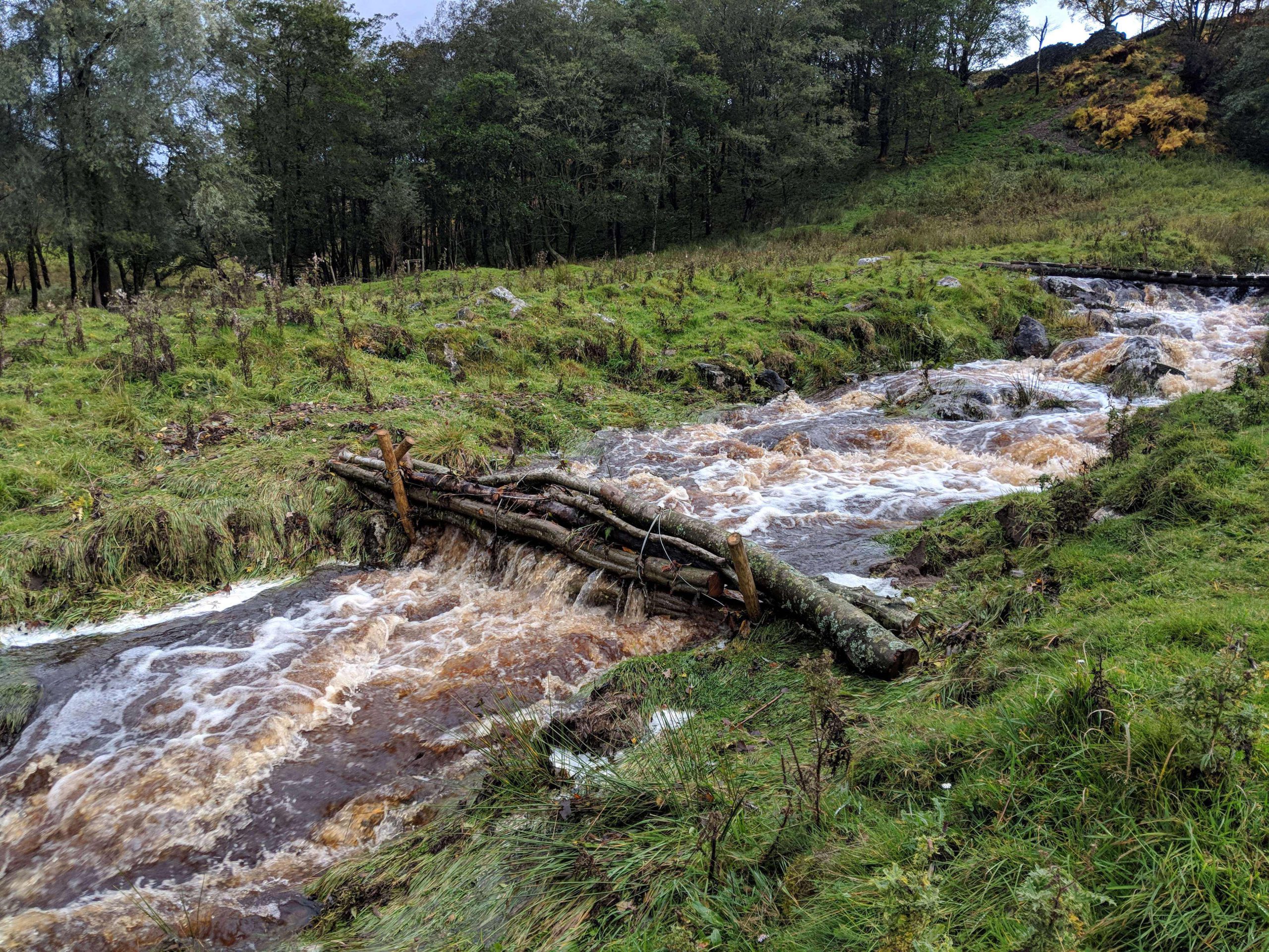
Image credit: Zora van Leeuwen
Working with natural processes can help to protect, restore and emulate the natural functions of river basins, floodplains and coasts to reduce flood risk whilst providing other benefits. This concept is sometimes also called Nature-based Solutions (NbS) or Natural Flood Management (NFM).
In 2017, the Environment Agency in England published an Evidence Base about the scientific evidence and state-of-art practices in NFM.
An updated evidence directory was published in February 2025, including a new review of the evolving research literature between 2017 and 2023.
We looked at the studies in that literature review, and geocoded them so that the literature base can be searched geographically.
Explore our maps
Alongside this map of WwNP scientific literature, we also host other interactive maps to support research and knowledge exchange:
Natural Flood Management (NFM) Areas of Potential
An interactive map that shows areas where different types of river and catchment management approaches have the potential to help reduce flood risk by working with nature.
Flash Flood Chronology
A database and interactive map of flash flood events in Britain derived from historical reports dating back over more than 200 years.