Wetropolis: Flood Modelling on a Tabletop
Can flood management processes be captured on a scale model?
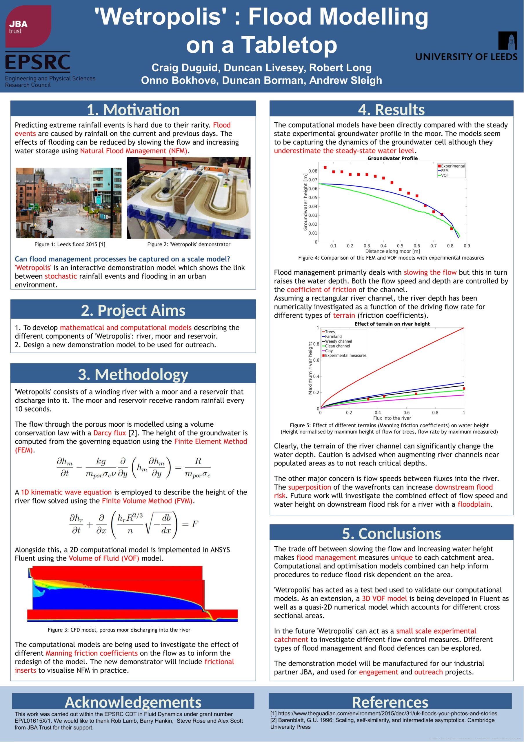
Wetropolis is an interactive demonstration model that helps visualise extreme flooding events. It shows the link between stochastic rainfall events and flooding in an urban area.
A team of PhD students from the EPSRC CDT in Fluid Dynamics at the University of Leeds set out to develop mathematical and computational models that describe the different components of Wetropolis: river, moor and reservoir.
The team found that flood management measures are unique to each river catchment and that computational and optimisation models combined can help inform flood risk management interventions.
Their poster summarises the project and the main findings.
.
Learn more about the Wetropolis Flood Investigator
Funding and support
The team project was carried out within the EPSRC CDT in Fluid Dynamics under grant number EP/L01615X/1 with support from JBA Trust.