Augmented Reality (AR) Sandbox
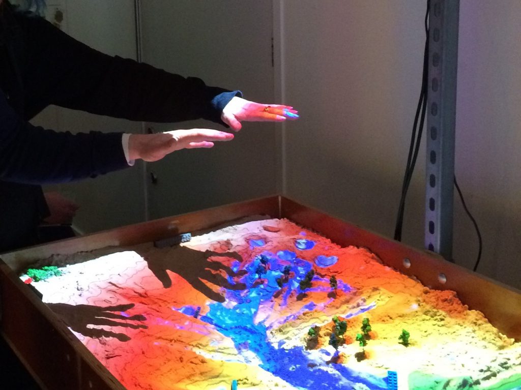
The AR Sandbox is a very interactive visualisation tool that shows how topography affects water moving through a catchment
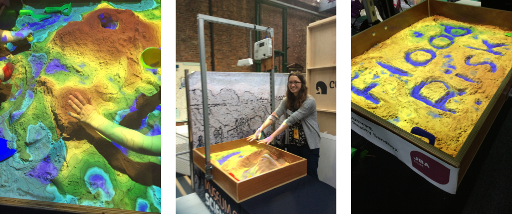
The sandbox is one metre square, and filled with loose, slightly damp sand. Participants can shape the sand to create their own river catchments and valleys which are then ‘augmented’ in real time by a projector which shows a coloured elevation map and contour lines.
By holding a hand above the sand, participants can ‘make it rain’ and then watch how the virtual water flows through the catchment in real time and explore how changes in topography and land use affect flooding.
Our first prototype was developed with students at the Lancaster Environment Centre as part of their MSc project and was based on the specifications shared by the University of California, Davis who have created an excellent library of online resources.
We are now exploring how we can develop new functionality in the software to enable us to better show concepts like natural flood management, including the impact of geological permeability, surface roughness and flood storage areas on flood risk.
This short film shows how the sandbox can be used to explore the different responses to rainfall of two contrasting river catchments.
On the left, there is a managed catchment with straight river channels, extensive upland drainage and housing built in the floodplain (blue bricks). The lack of upland water storage means that rainfall runs off very quickly, flooding the downstream catchment. Housing to the right of the river is protected by engineered flood defences (orange bricks).
On the right, there is a more natural catchment with a meandering river channel, upland water storage (run-off attenuation features) and leaky dams all slowing the flow of water. With the same amount of rainfall, the water takes longer to reach the lower catchment and more water is retained in the upper catchment compared to the other catchment.
Factsheet: Dimensions, demonstration requirements and other vital statistics are available in this factsheet.
Resources: The resources provided by UC Davis for the AR Sandbox community are available here.
Find out about our other physical models here, and watch other JBA Trust videos on our YouTube channel.
Learning resources

Learning Resources: Rivers
Learning resources to help understand how engineered structures in the river channel, like culverts, screens and weirs, affect water flow and local flood risk.

Learning Resources: Catchments
Learning resources to help explore how different landscapes and land uses can affect how water flows and the risk of flooding

Learning Resources: Weather and climate
Learning resources to help understand the principles of weather monitoring, why it’s important and how this links to weather hazards and our changing climate.

Learning Resources: Coasts
Learning resources to help explore how different types and combinations of coastal defences can improve resilience to coastal flood risk and erosion.